Home » Blogs » GIS » Sensor based Geospatial Activity monitoring
Live Location monitoring
in real time
Need
Live location monitoring is needed across domains to
Optimize routes in navigation
Provide swift response during emergencies
Manage assets or fleets of vehicles
Improve response times during emergencies
Kaiinos work
Kaiinos is working with organizations to improve the efficiency of live tracking their activities as well as assets. These solutions are deployed keeping in mind the economics of scale. The customization of our product helps in handling volume, velocity and variety of datasets and thus making it a starting point to delve into big data world.
Application design
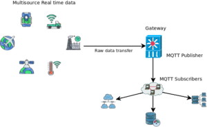
Our product consumes datasets from sensors placed in static objects or on moving objects. Based on the communication protocol right interfaces are written to post dataset to spatial databases. MQTT is used to feed raw data to multiple subscribers. The subscribers may be cloud APIs, database pools or network streams.
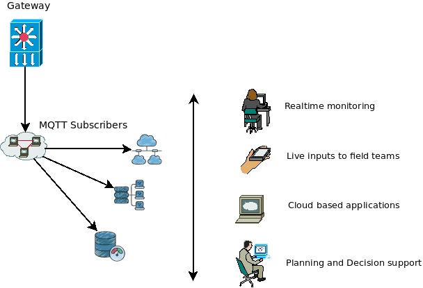
Deployment
Product is customized to cater to the end users enabling them to monitor activities/assets. In certain cases like outages push notifications are sent to field teams to respond in time. The tech that we use is cloud ready and thus enables users in remote locations to monitor activities across diverse geographies.
Aggregated information or reports are fed to traditional OLTP systems for planning and decision support.